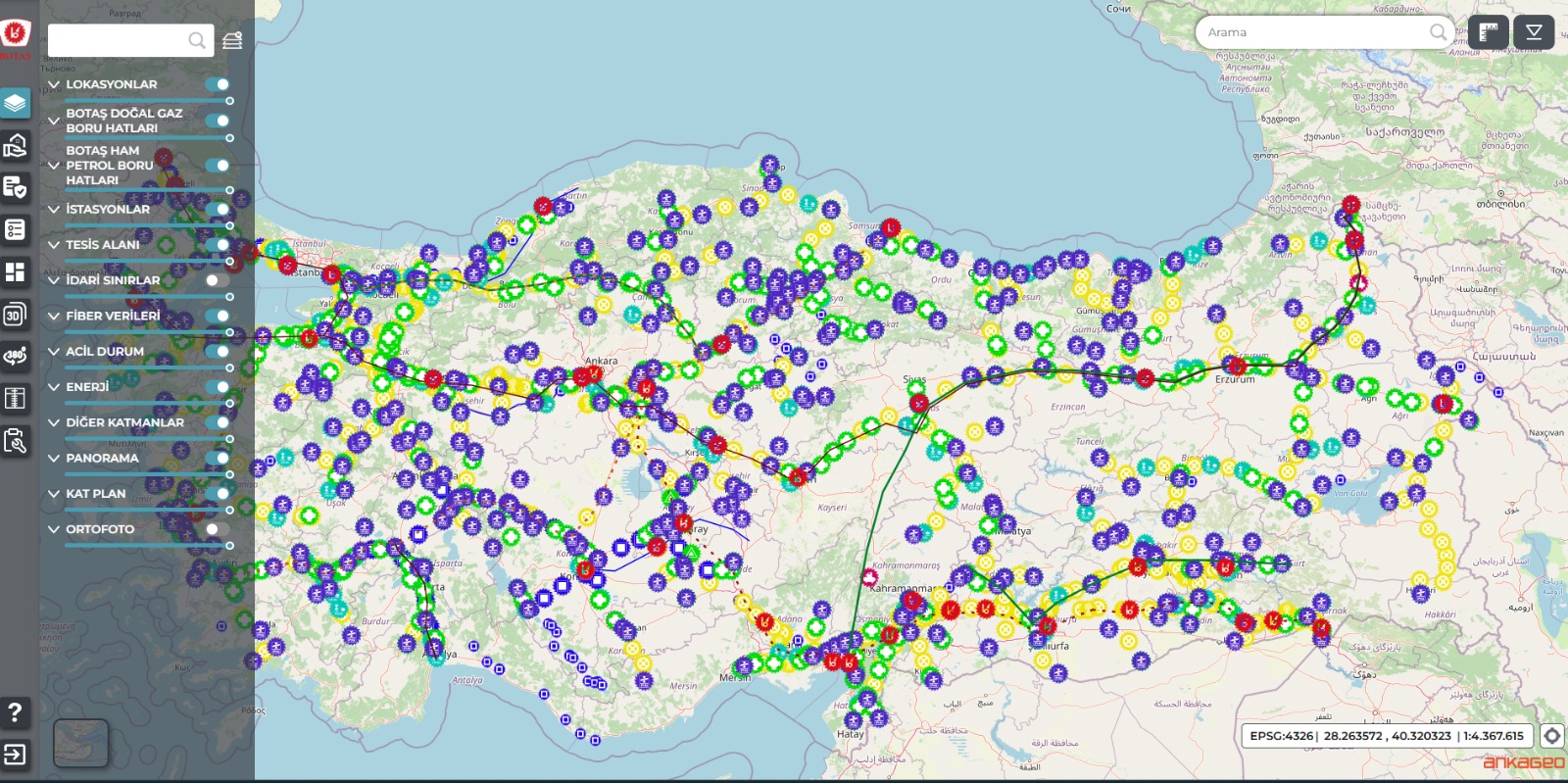
A map-based oil and natural gas asset management system is a web-based software used to manage oil and natural gas infrastructure on a single digital map.
The system stores and manages both location (spatial) and information (attribute) data of pipelines, LNG facilities, RMS, FSRU, PIG stations, storage areas, parcels, buildings, and other related assets.
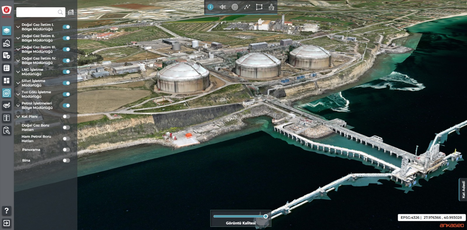
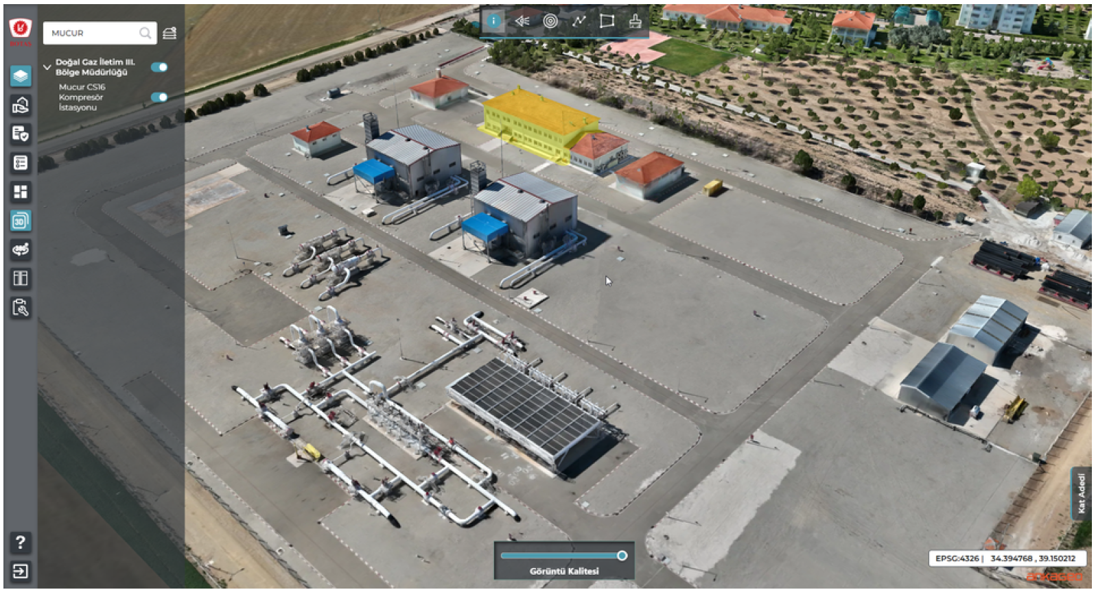
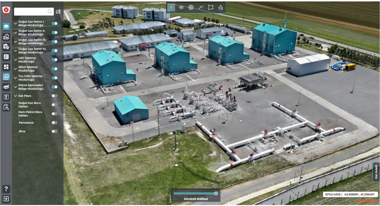
With 2D and 3D maps, orthophotos, and integration with company systems, users can easily monitor, search, analyze, and report assets. This helps organizations make better and faster decisions.
Key Features
Map-Based Architecture: Enables spatial management of all oil and natural gas assets on a single unified map.
2D and 3D Visualization: Provides detailed inspection through orthophotos, 3D facility models, and 360° panoramic imagery.
Centralized Asset Management: Ensures holistic management of pipelines, facilities, and infrastructure inventories.
Dynamic Reporting and Dashboards: Offers real-time and comparative reports based on region, facility, and asset.
Advanced Querying and Analysis: Supports spatial queries, measurement tools, and thematic maps.
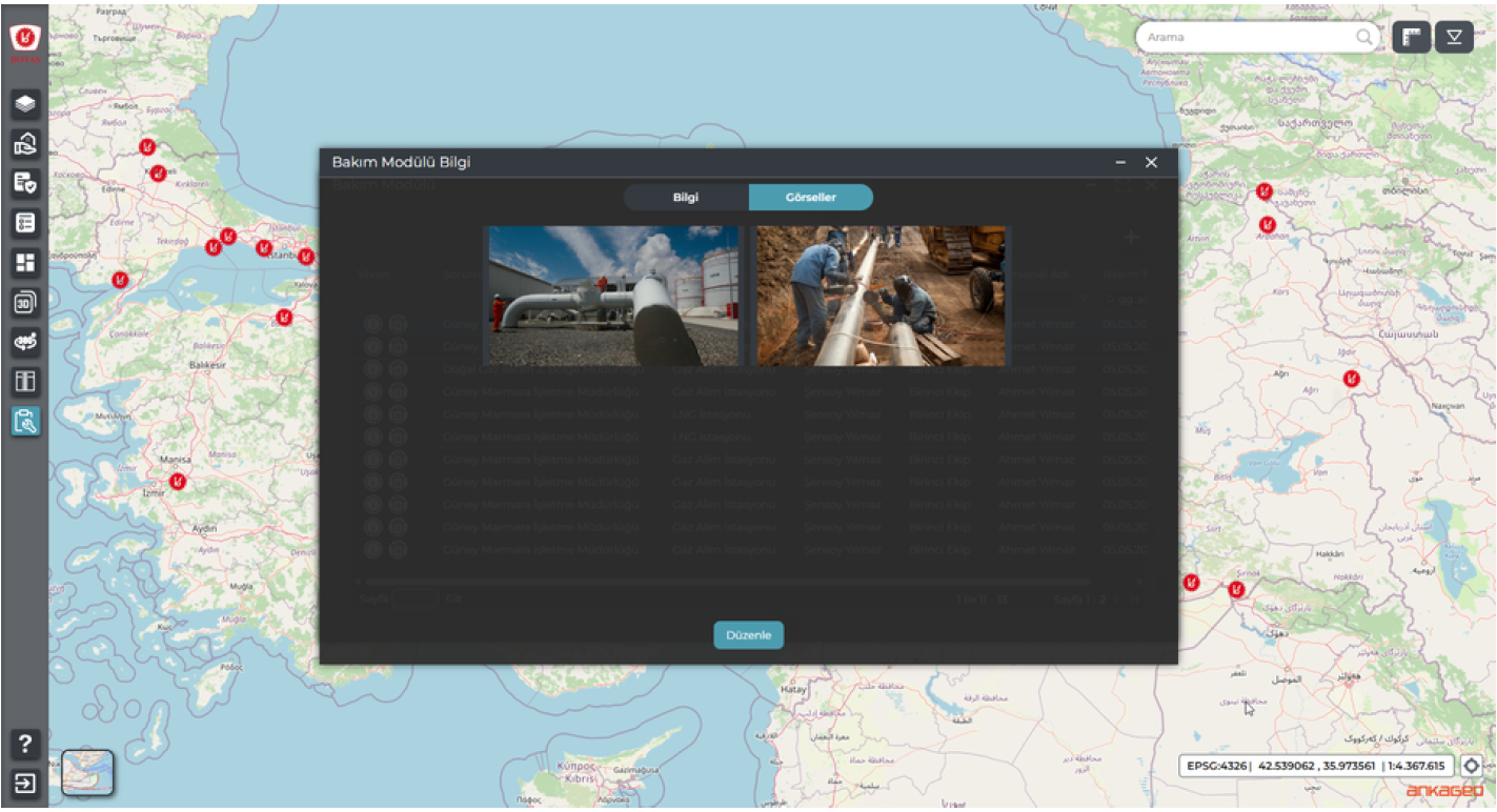
Maintenance and Damage Management: Allows digital tracking of maintenance records, damage monitoring, and visual documentation.
Asset and Insurance Valuation Modules: Manages up-to-date, standards-compliant asset valuation and insurance information.
Enterprise System Integration: Seamlessly integrates with existing corporate systems and data sources.
Role-Based Authorization: Enables flexible definition of user permissions based on roles and responsibilities.
Security and Audit Trail: Logs all user activities to ensure traceability and auditability.
Web-Based Architecture: Accessible through a browser without requiring any installation.
Conveniences and Benefits Provided by the System
- Enables management of all oil and natural gas assets’ spatial and attribute data within a single platform.
- Provides fast access to assets along with efficient querying and analysis through a map-based structure.
- Allows asset inspection via 2D and 3D visualizations without the need for on-site visits.
- Accelerates decision-making by providing real-time access to accurate and consistent data.
- Delivers effective monitoring and reporting through regional- and facility-based dynamic dashboards.
- Simplifies the digital management of maintenance, damage, and valuation processes.
- Reduces data duplication and manual operations through integration with internal corporate systems.
- Improves operational efficiency by saving time and costs.
- Enhances data security through role-based authorization and comprehensive audit trails.
- Provides a strong decision-support infrastructure for sustainable asset management and long-term planning.