

Mapping
Mobile Mapping Software
Software platform that processes sensor data collected from mobile vehicles to create 360° panoramic maps, inventory data, and up-to-date urban information systems.


An integrated municipal management system that brings together citizen services, licensing and zoning processes, infrastructure and field work, human resources, and reporting on a single platform to ensure fast, transparent, and efficient service delivery.
MAKS Integration is an integration structure that ensures the management of address data in the municipality is fully compatible and up-to-date with the National Address Database.
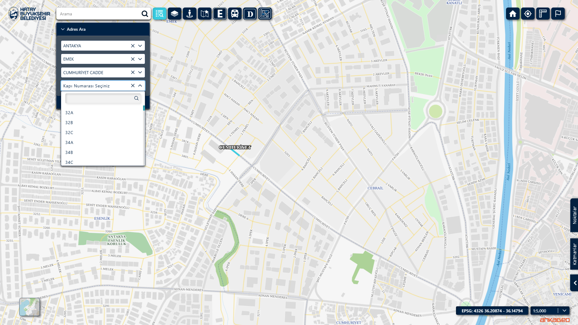
Thanks to this integration, which is fully compatible with the National Address Database (MAKS), address data in the municipality is managed in an up-to-date, standardized, and perfectly matched manner with the central system. Address errors are reduced, processes are automated, and internal data accuracy is increased.
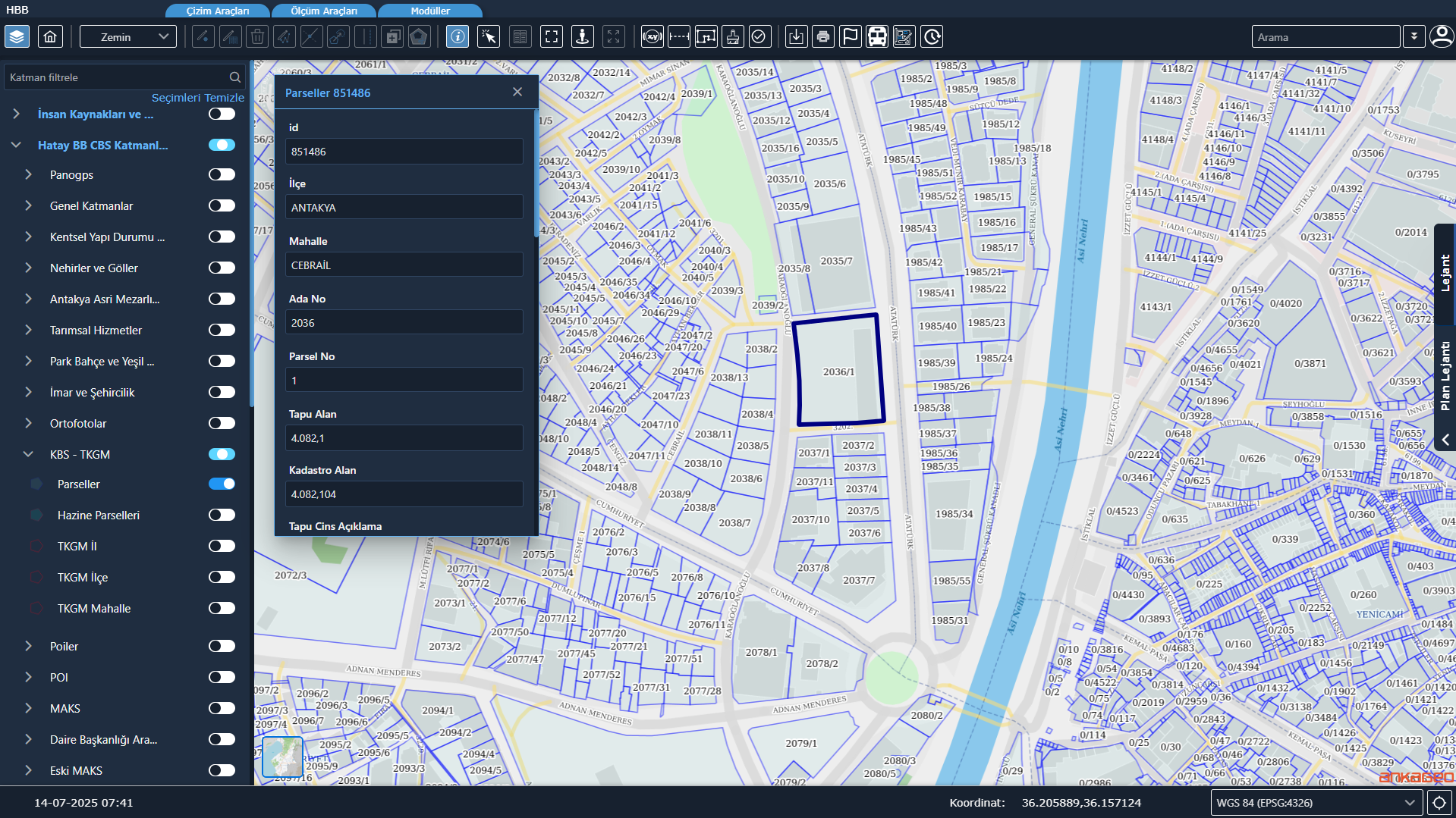
TKGM Integration is an integration infrastructure that enables the transfer of land registry and cadastre data from the General Directorate of Land Registry and Cadastre systems to the municipal information system in an up-to-date, accurate, and standardized manner.
An address card is a numbering document that enables the production and verification of official address information for a building or unit in a standard format.
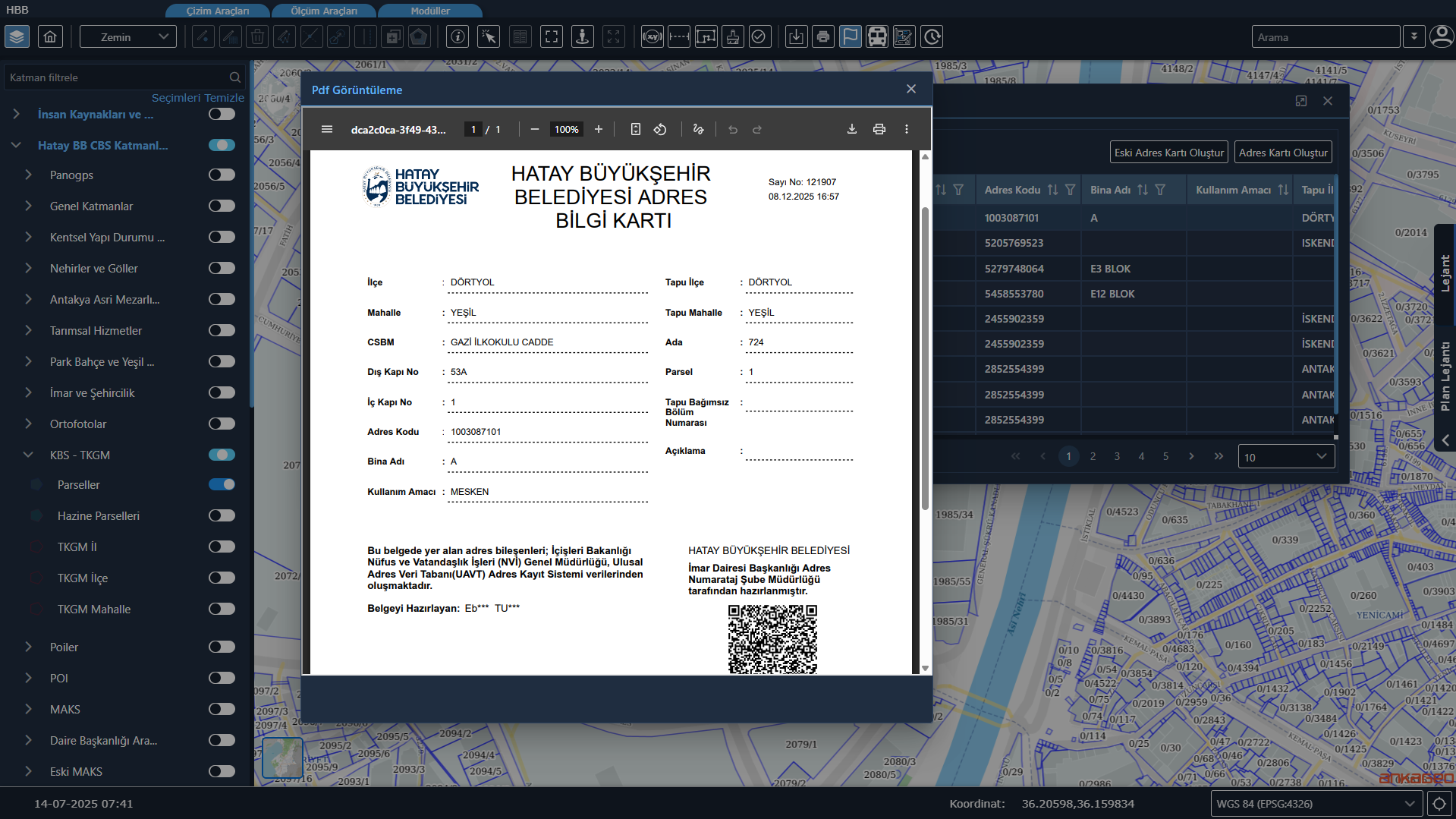
It enables the digital numbering of all buildings, doors, roads, and streets within the municipality’s boundaries. Address card generation, numbering, updating, and verification processes are managed from a single screen. The generated documents are verifiable via a QR system.
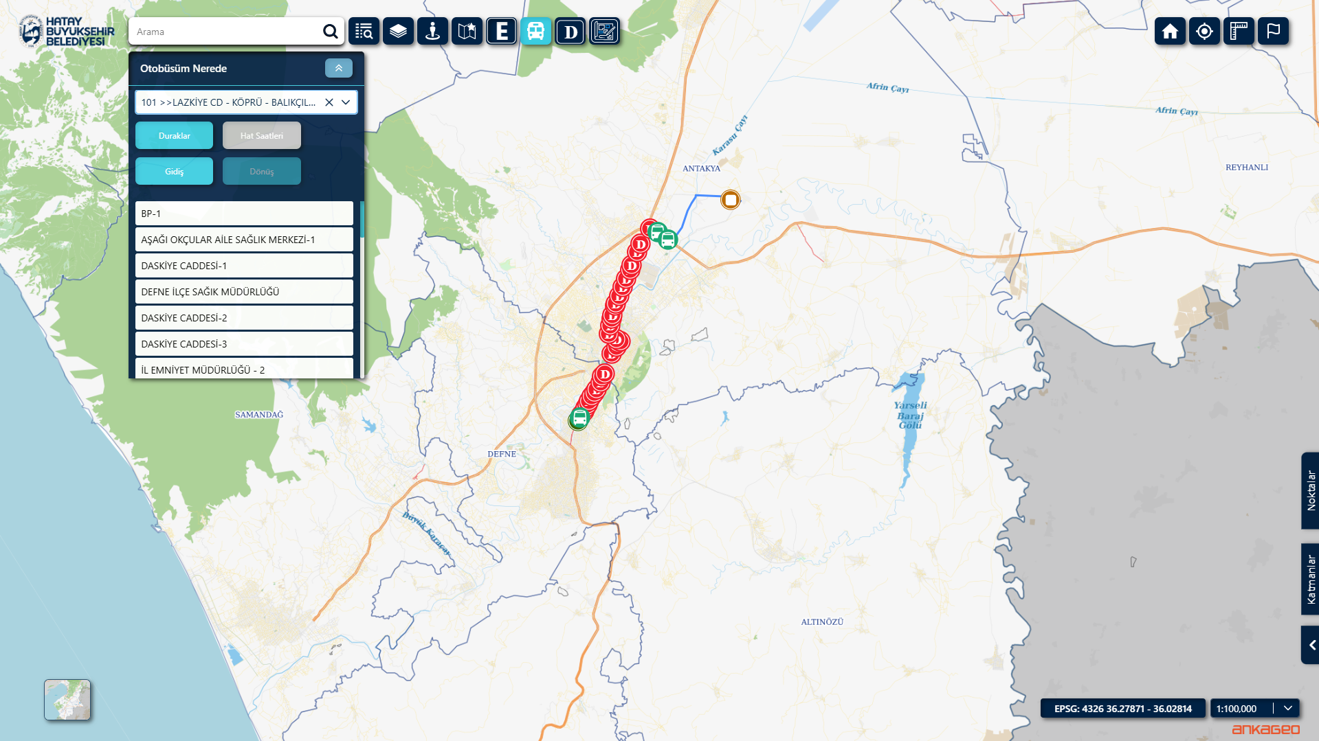
Public Transportation Information System Integration is an integration project that enables the unification of data from the municipality’s existing public transportation software and location services onto a central GIS/map infrastructure. Within this scope, information on public transportation stops, bus lines, and routes is automatically transferred from the relevant systems; live location data from vehicles is displayed instantly on the map. Thanks to this integration, data from different sources are made consistent, up-to-date, and viewable through a single platform, strengthening the municipality’s operational management, monitoring, and decision-making processes.
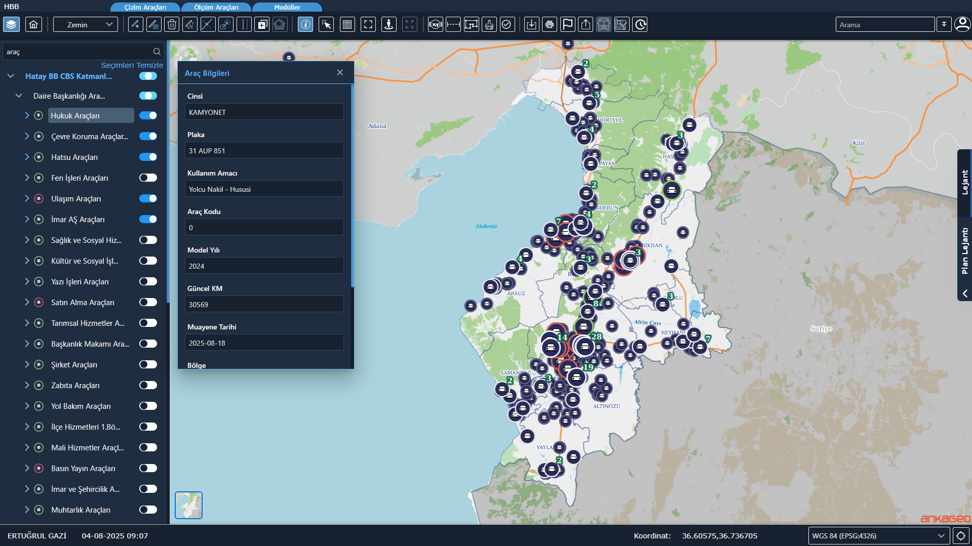
Vehicle Tracking System (ATS) Integration is a project that enables the integration of location and vehicle information data from municipal service vehicles with a centralized map infrastructure. Within this integration, the live locations of vehicles can be monitored in real-time; detailed vehicle information such as license plate, vehicle type, affiliated unit, and duty status can be viewed on map and detail screens. Furthermore, an authorization mechanism is implemented based on the branch directorates to which the vehicles are affiliated, ensuring that users can only view the vehicles and data for which they are authorized; thus, both increasing data security and creating an efficient and controlled vehicle management infrastructure.
The Disaster Module is a decision support system that enables the monitoring and management of critical data in map-based formats during disasters such as earthquakes, floods, and fires, and coordinates response processes.
The Disaster Module is a comprehensive system that supports crisis management by bringing together vital information such as assembly areas, risk zones, damage assessments, critical facilities, infrastructure status, and disaster response resources on a single platform.
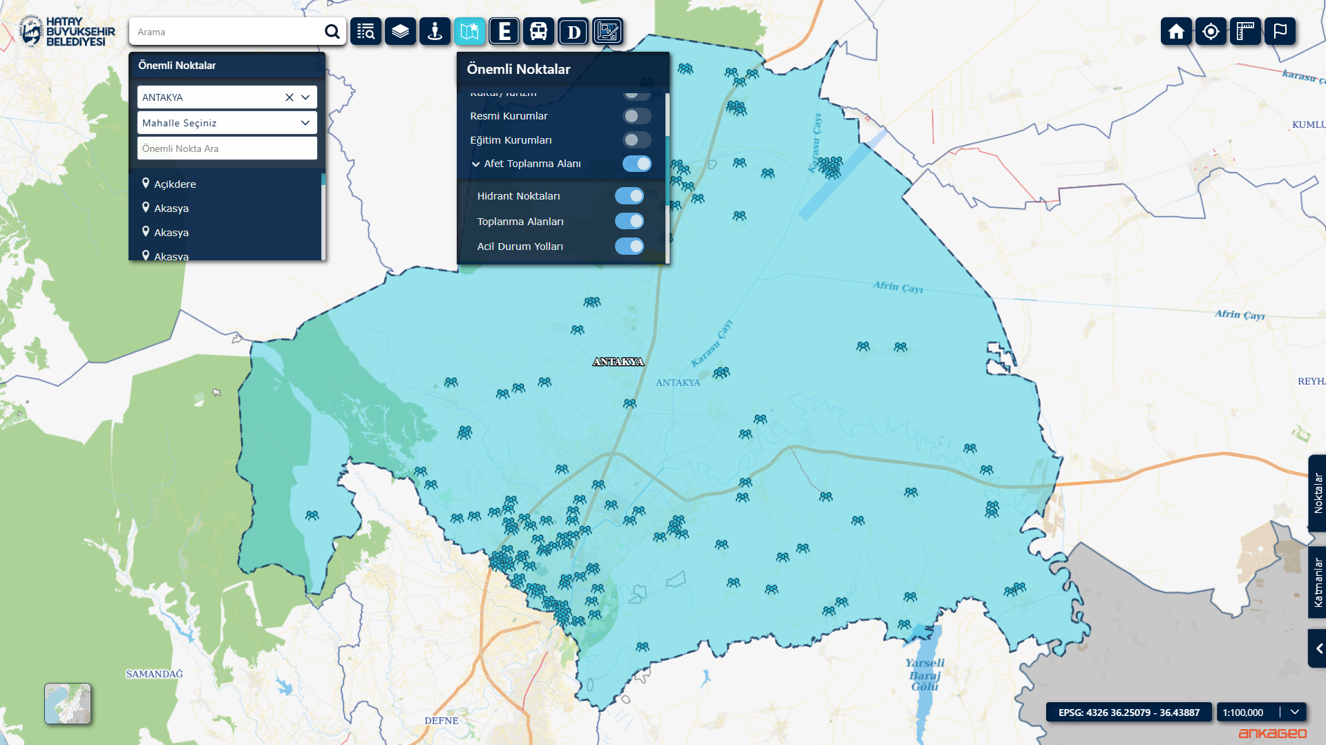
The module is designed for use throughout the entire process, from pre-disaster preparedness to disaster operations, and offers the following capabilities:
Mapping and analyzing risky areas, building stocks, and critical infrastructure.
Managing assembly areas, shelters, and evacuation routes.
Coordination of field teams and resources during a disaster.
Real-time collection of damage assessment data from the field and its visualization on a map.
Producing reports and situation analyses regarding the intervention process.
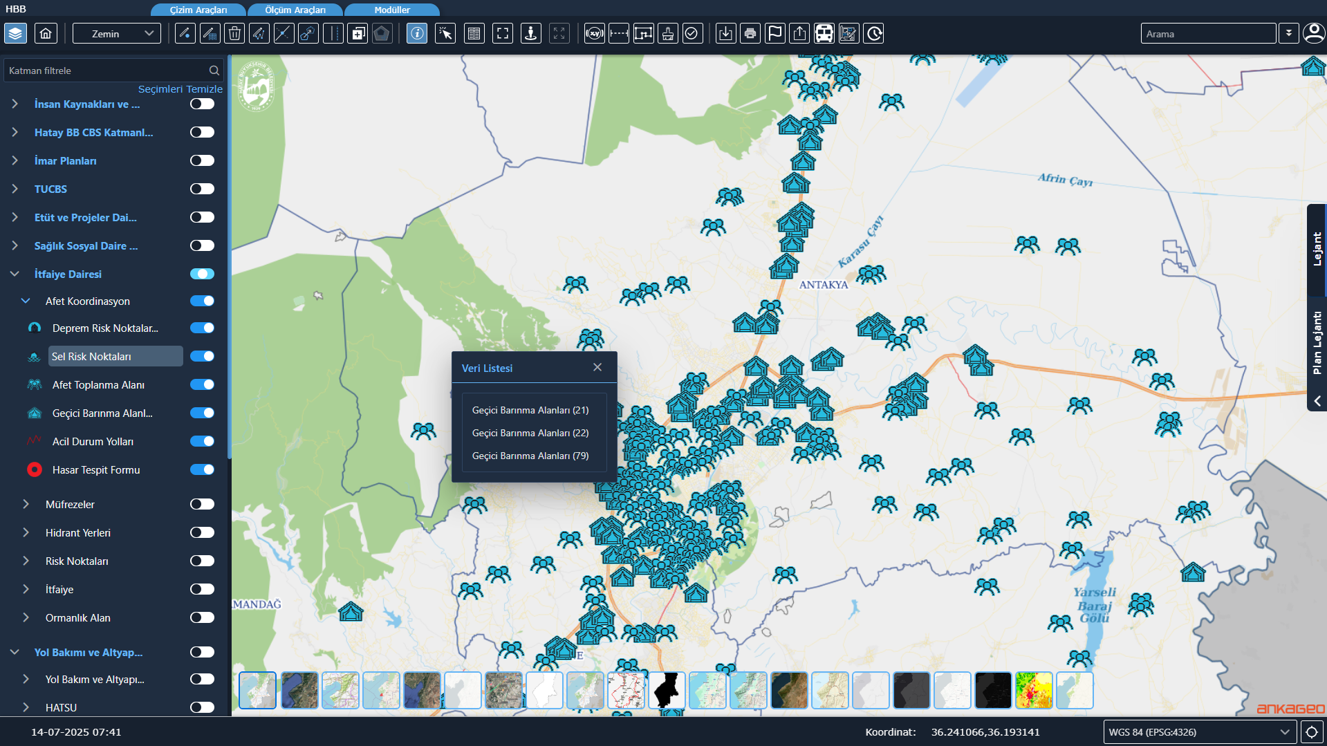
This structure strengthens municipalities’ disaster preparedness, enables rapid decision-making during crises, and contributes to more effective response processes.
Implementation Zoning Plans and Master Zoning Plans are displayed on map screens via services shared by the Ministry of Environment and Urbanization.
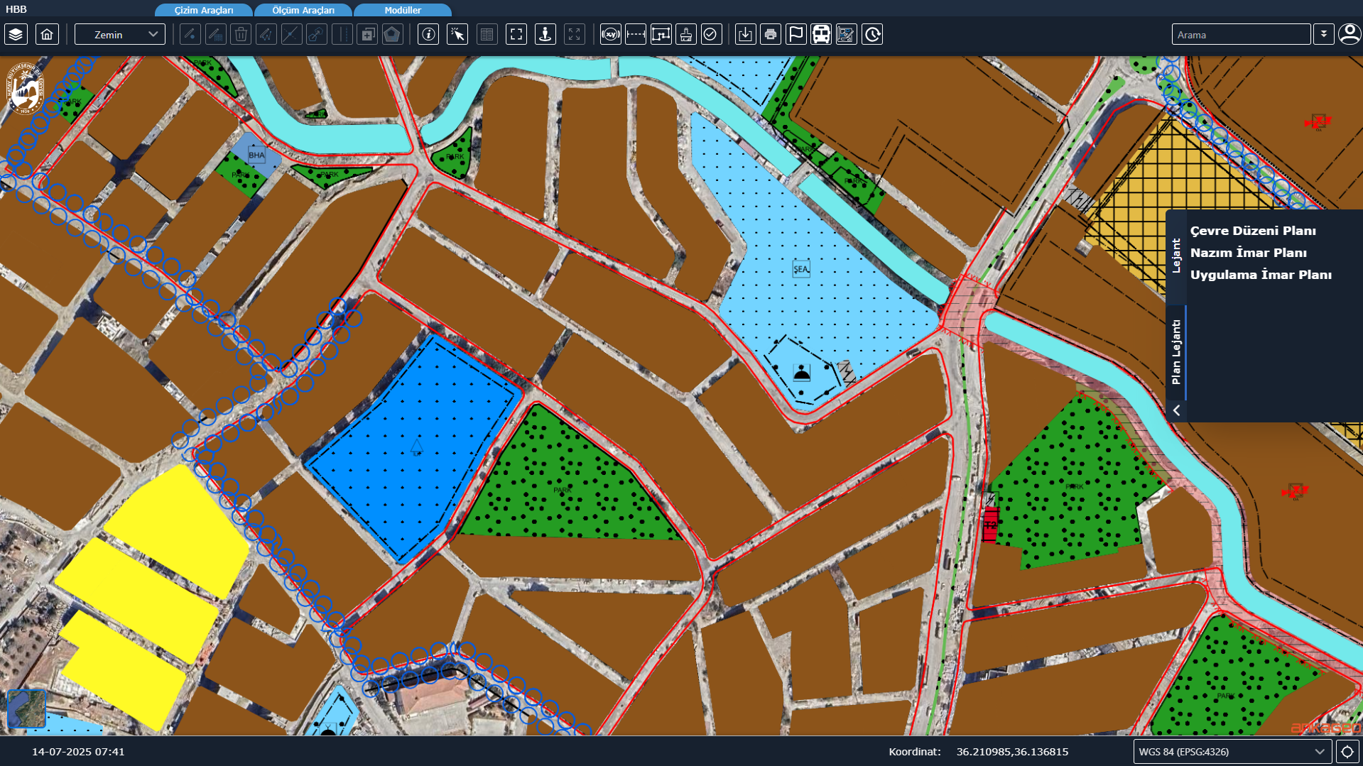
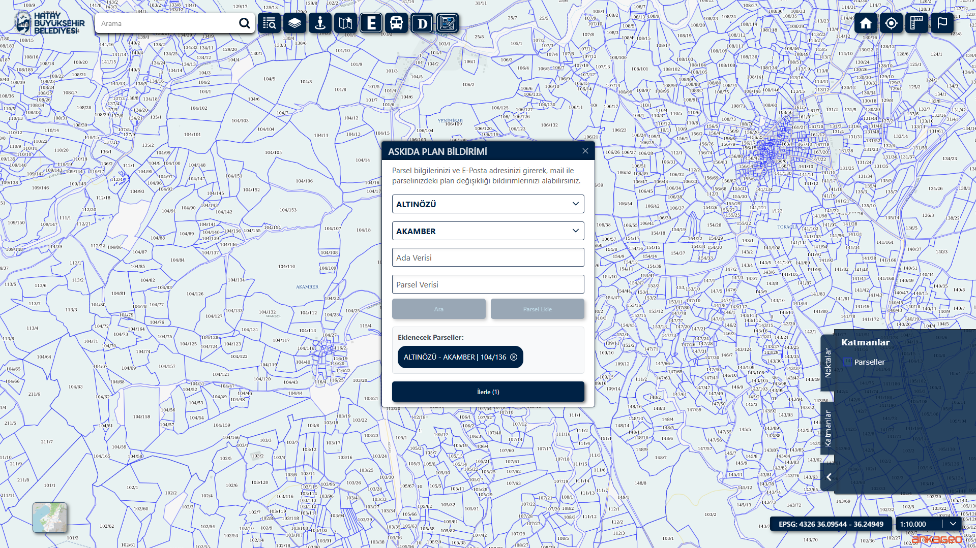
Plans added via the Suspended Plan Screens are presented to the public during the suspension period. Citizens are informed via email of any plan changes related to their plot.
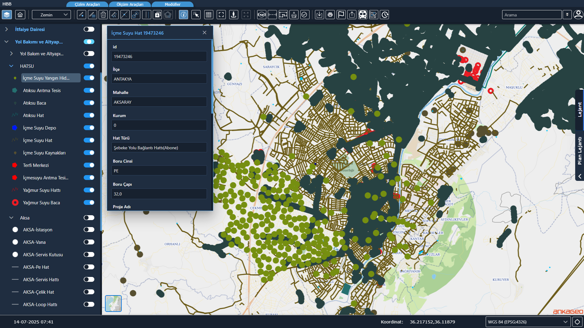
It enables the geographical visualization and management of infrastructure lines such as water, sewage, electricity, fiber optic, and natural gas. It accelerates intervention, planning, and project processes.
The Map Service Module enables the municipality’s map application to be used as a service within other corporate software and facilitates bidirectional integration with these applications. In this context, the map screen can be opened within different applications, allowing for querying, viewing, and processing; data from these applications can be linked to the map. Thanks to this module, the map infrastructure is transformed into a central service, enabling the use of common, up-to-date, and consistent spatial data across internal and integrated systems.
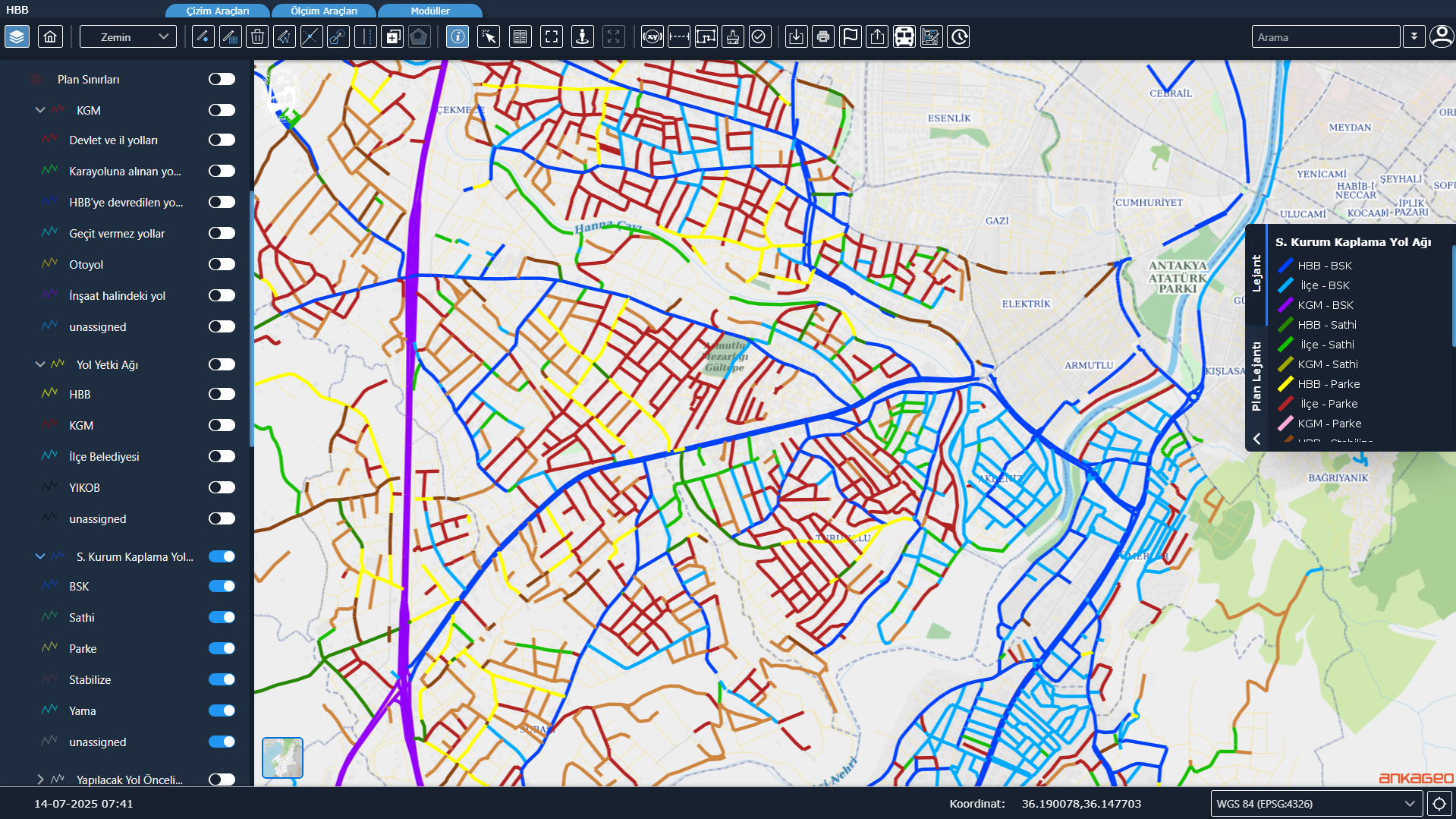
The district’s transportation network is updated, and detailed reports are generated regarding road lengths, road types, surfaces, and seasonal changes. This provides decision support for strategic transportation planning.
Software platform that processes sensor data collected from mobile vehicles to create 360° panoramic maps, inventory data, and up-to-date urban information systems.

Asset Management System is a comprehensive system developed to address the complex asset management issues faced by modern businesses. This system allows organizations to effectively monitor, analyze and manage their assets on a location-based basis.

It is a system created in order to record the data of public investment projects developed throughout the country through a single system, to monitor investment projects instantly and on a provincial / district basis, to view and analyze provincial budgets.
MAKS Integration, TKGM (Parcel) Integration, the Numbering Module (Address Card) and Public Transportation Information System Integration are the main modules; citizen services, zoning processes and field work are managed on a single platform.
It ensures that municipal address data is managed fully compatible with the National Address Database (MAKS), up-to-date and standardized; address errors are reduced, processes are automated and data accuracy increases.
Numbering operations for all buildings, doors, roads and streets within municipal boundaries are carried out digitally from a single screen; address card generation, numbering, updating and verification are managed, and documents are produced verifiable via a QR system.
It transfers land registry and cadastre data from the General Directorate of Land Registry and Cadastre systems to the municipal information system in an up-to-date, accurate and standardized manner.