Mobile Mapping is the process of collecting spatial data from mobile vehicles such as cars, drones, boats, trains or airplanes.
Mobile Mapping is the process of collecting spatial data from mobile vehicles such as cars, drones, boats, trains or airplanes. Vehicles can be equipped with a range of sensors:
Positioning (GNSS, GPS)
Cameras
LiDAR
Radar
Remote sensing systems
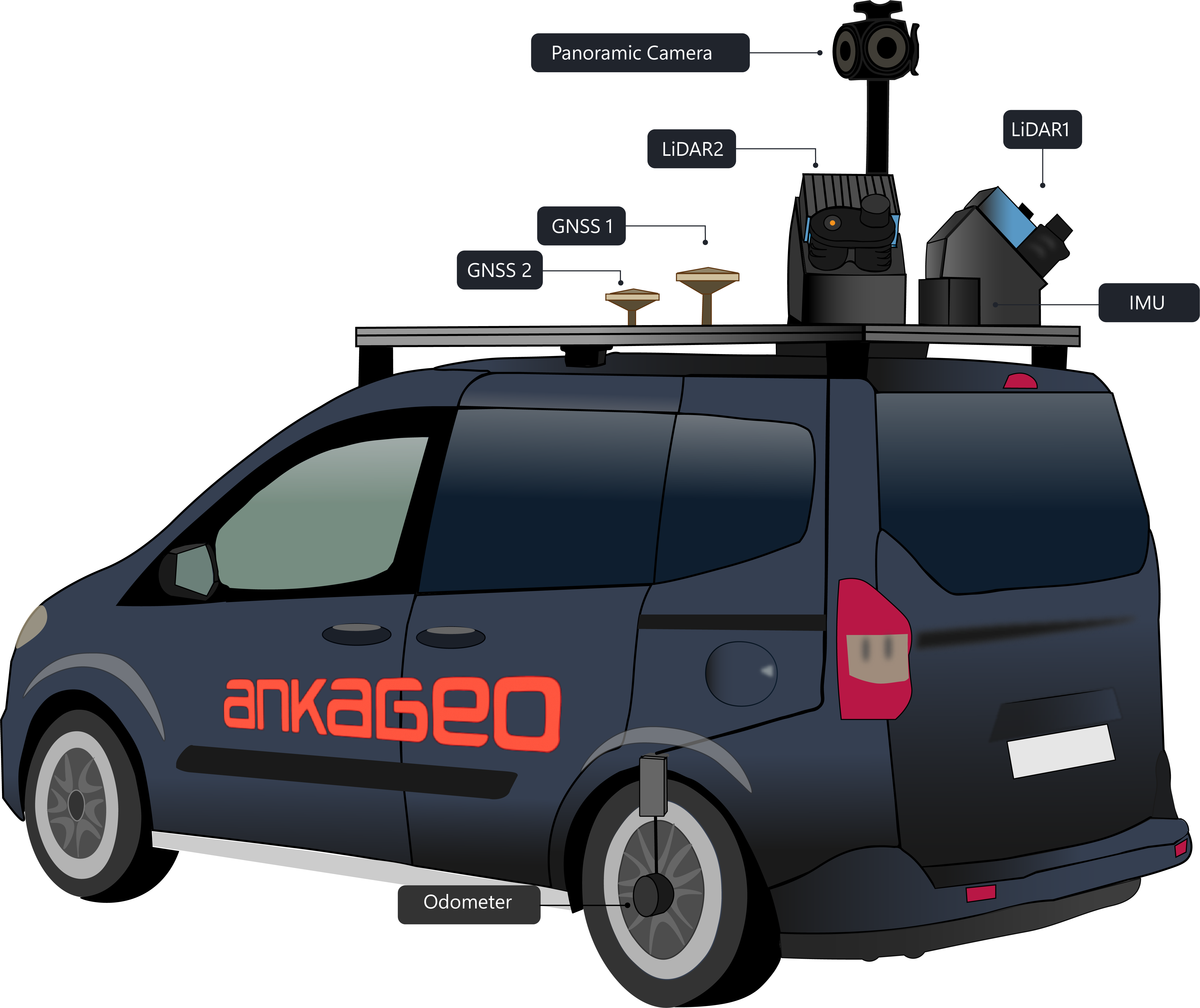
Through these systems it is possible to collect:
Light Detection and Range (LIDAR): Optical remote sensing technique that uses laser light to heavily sample the Earth’s surface.
Street-level (planar and panoramic) images: Photos taken from the perspective of pedestrians or moving vehicles.
Aerial images: Photographs taken from above of an area using any manned or unmanned aerial vehicle.
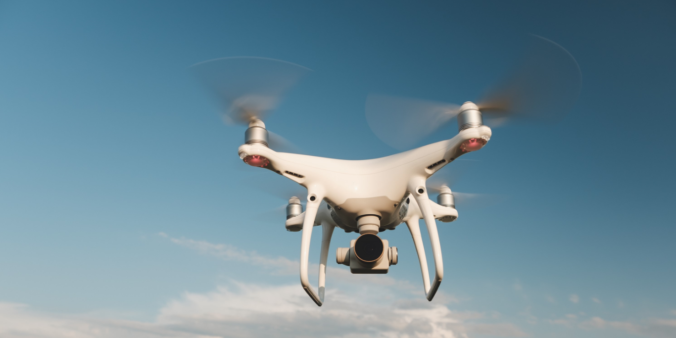
Examples of application areas are:
Road / rail network management
Asset Management
Data collection for oil and gas, mining, energy and historical areas
Site monitoring Environmental monitoring
Industrial inspections
Street view data collection
Surveillance and security etc.
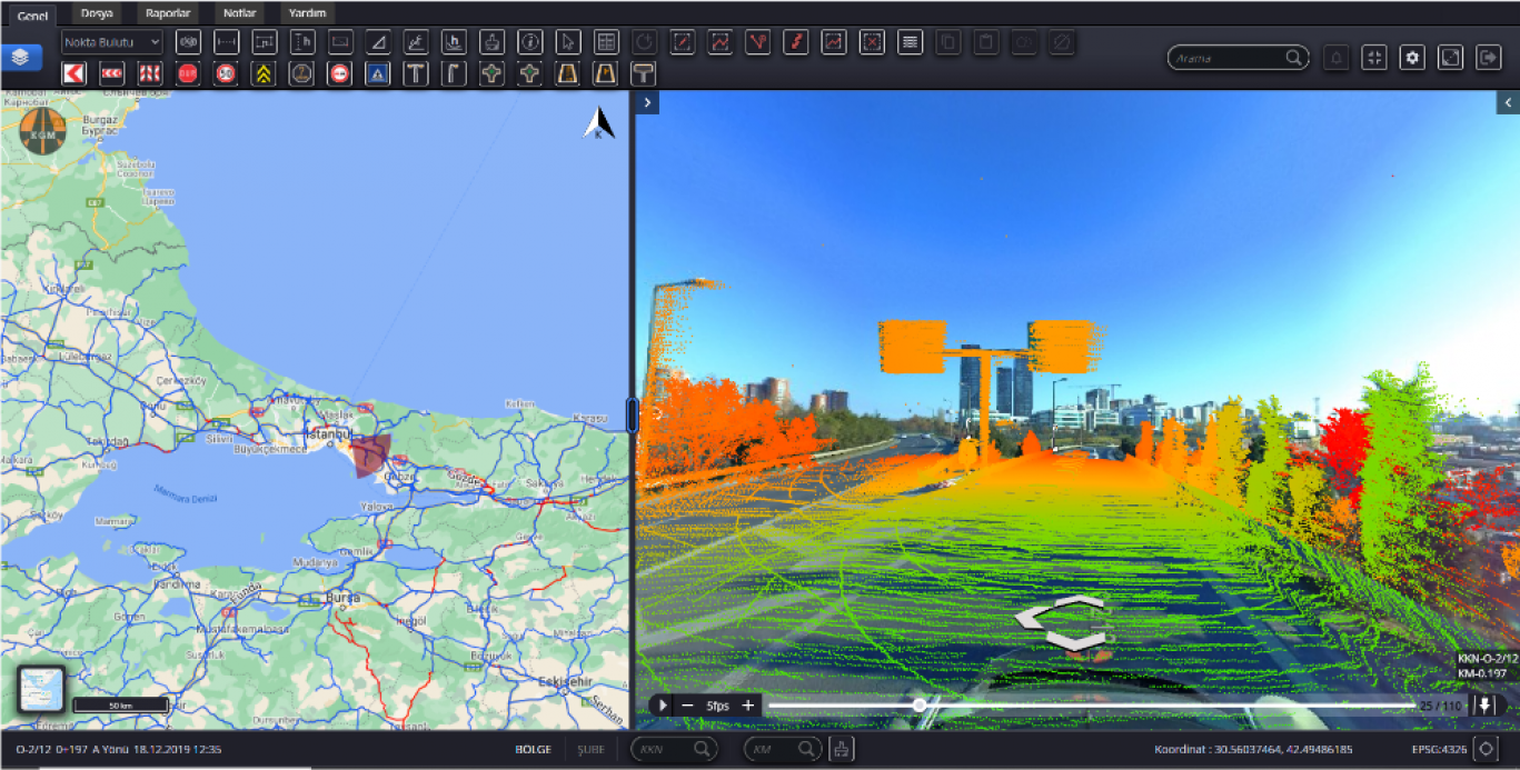
Speed: Mobile Mapping is much faster than traditional measurement methods. According to a study by the Project Management Association (APM), it can be up to 40 times faster than traditional static scanning tools.
Efficiency: Mobile mapping systems increase your scanning efficiency. For large projects with budget constraints and time pressure, the use of mobile mapping devices allows you to be faster and take on more projects with your existing workforce. Therefore, it is significantly more cost effective.
Safety: Mobile scanners can be operated remotely via autonomous vehicles or UAVs, making it possible to investigate and map difficult-to-access or dangerous environments.
To summarize, Mobile Mapping consists of vehicle-mounted cameras, sensors and lidars that collect spatial data. It can be used in areas that will meet the various needs of both public and private institutions. Using Mobile Mapping Systems is cost effective and easy to use.
Mobile mapping is the collection of spatial data from moving platforms such as cars, drones, boats, trains or aircraft equipped with GNSS, cameras, LiDAR and radar sensors. It produces LiDAR point clouds, street-level panoramic images and aerial imagery.
It is up to 40 times faster than traditional static scanning tools and lets teams take on more projects with the same workforce, which lowers cost. Because scanners can be operated remotely from autonomous vehicles or UAVs, hard-to-reach or hazardous areas can be mapped safely.
Typical application areas include road and rail network management, asset management, data collection for oil and gas, mining, energy and heritage sites, construction site and environmental monitoring, industrial inspections, street-view data capture, and surveillance and security.